Bogota, Colombia
CNN
—
Hundreds of families in Colombia are facing a choice: abandon their homes and livelihoods, or face the devastation of a predicted volcanic eruption in the coming weeks.
The Nevado del Ruiz volcano, one of Colombia’s highest peaks, sits in a densely populated farming area and is infamous for claiming the lives of tens of thousands of people in a massive 1985 eruption.
Since March 30, the volcano has been on orange alert, signifying that “an eruption is likely within days or weeks,” according to Colombia’s Geological Service.
Towns and villages around the mountain have been asked to evacuate, with local and national authorities declaring a state of emergency. Most nearby schools have gone back to pandemic-era home learning plans and local municipalities are stockpiling first aid kits.
On April 5, Colombian President Gustavo Petro ordered the voluntary evacuation of about 2,500 families in the area as a precaution, but many locals have refused, saying they are more worried about leaving their livelihoods and belongings behind than about potential lava flows.

While it’s unclear how many families in total have evacuated, Tolima’s civil protection unit director Luis Fernando Velez told local newspaper El Tiempo on Thursday that only a small fraction – just 87 people – had left their homes under his agencies’ watch.
The slopes of the Nevado del Ruiz, located between the Tolima and Caldas provinces in central Colombia, are fertile grounds for local farmers, who say leaving their cattle behind would ruin them.
The local government in the province of Tolima has announced plans to evacuate up to 12,000 cattle, out of a total of over 43,000.
Omar Valdes, Tolima’s rural development secretary and the officer in charge of the cattle evacuation, said farmers were resisting the evacuation order because of previous bad experiences.
“In previous occasions they evacuated, floods [caused by the volcano] didn’t affect their farms and when they came back the farmers found that most of their goods and cattle had been stolen,” he explained.
Eruptions from the Ruiz volcano can be particularly lethal, according to scientists at the Smithsonian Institute’s Global Volcanism Program, because the top of the peak is permanently capped by a layer of snow and ice. Once in contact with the lava, the snow and vice would instantly melt, flood over the slopes of the mountain in torrential mudslides called lahars.
Such a tragedy struck on November 13, 1985, the last massive eruption of the volcano, which is collectively known in Colombia as the Armero Tragedy. On that occasion, just a couple hours after the Ruiz volcano began to erupt, a river of mud, rocks, lava, and icy water swept over the small town of Armero. The flood killed over 23,000 people in a matter of minutes.
Many local residents still remember the trauma of that day, but few are willing to gamble their livelihoods on geologists’ warnings alone. The same volcano erupted in 2012 without causing any deaths.
While Tolima and Caldas are part of the relatively wealthy coffee-growing region of Colombia, most economic activity is run by small-scale farmers who own a limited number of animals and tend to small parcels of land and for whom the cattle and agricultural equipment they own are their most valuable belongings.
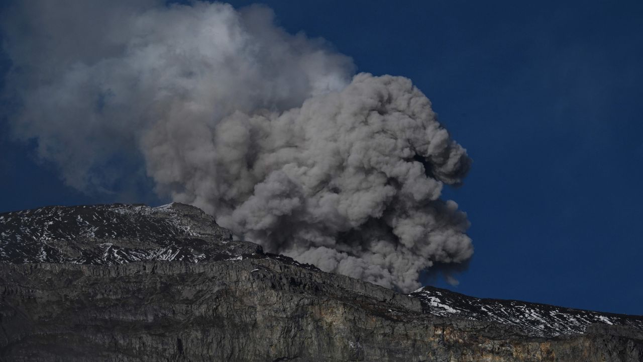
Though the increasingly active volcano is monitored daily by dozens of probes, it is impossible to forecast exactly whether it will erupt, let alone when. Still, there are troubling signs.
“Right now, the volcano is ejecting steam, ashes, gases, and closer to the crater there’s been a high level of seismicity,” said Luis Fernando Velasco, the Director of Colombia’s risk management unit UNGRD, in a video statement last week.
Recently, the ground around the volcano has been shaken by hundreds, sometimes thousands of small tremors per day. And on Friday, a column of ashes and smoke originating from the volcano rose onto the sky for over 1500 meters (approximately 5000 ft), according to a report by the Colombian Geological Service.

